ስዕል:Map-Lusophone World-en.png

Size of this preview: 800 × 370 pixels. Other resolutions: 320 × 148 pixels | 640 × 296 pixels | 1,357 × 628 pixels.
ዋና ፋይል (1,357 × 628 ፒክስል፤ መጠን፦ 37 KB፤ የMIME ዓይነት፦ image/png)
ማጠቃለያ
| ማጠቃለያ |
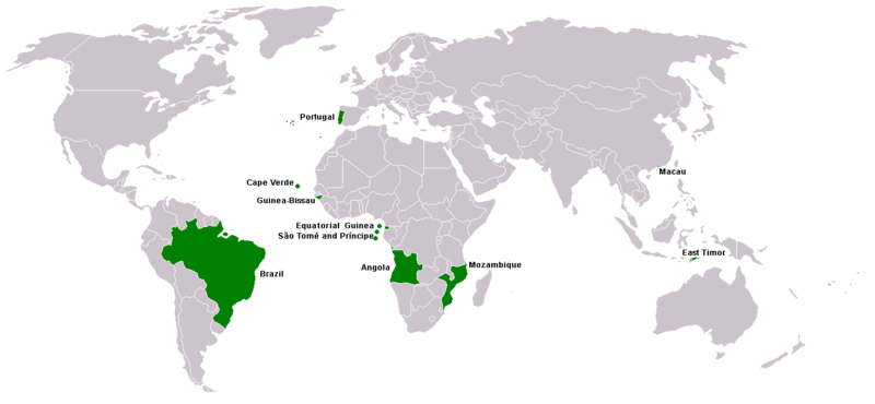
Map of Lusophone world. Map made from Image:BlankMap-World.png. The blank map was made by User:Vardion and adapted by User:E Pluribus Anthony for Wikipedia. |
||||
| ቀን | |||||
| ምንጭ | Own work | ||||
| አቅራቢው | This version was made by User:Yug with country names by User:Sting. Fixed by User:The Ogre | ||||
| የማብዛት ፈቃድ (Reusing this file) |
|
||||
| ሌሎች ዕትሞች |
|


የፋይሉ ታሪክ
የቀድሞው ዕትም ካለ ቀን/ሰዓቱን በመጫን መመልከት ይቻላል።
| ቀን /ሰዓት | ናሙና | ክልሉ (በpixel) | አቅራቢው | ማጠቃለያ | |
|---|---|---|---|---|---|
| ያሁኑኑ | 21:35, 7 ማርች 2018 | | 1,357 × 628 (37 KB) | Maphobbyist | South Sudan border |
| 15:13, 21 ኤፕሪል 2016 |  | 1,357 × 628 (14 KB) | Avayak | optimized losslessly | |
| 23:09, 22 ፌብሩዌሪ 2008 |  | 1,357 × 628 (47 KB) | The Ogre | New version, taken from the English wikipedia, where en:User:Domaleixo had done a new version of this map adding Equatorial Guinea, that also has Portuguese as official language. The license is "I, the copyright holder of this work, hereby release it | |
| 03:20, 4 ጁን 2007 |  | 1,357 × 628 (47 KB) | Hoshie | added Cabinda (Angola) and Montenegro. Same license. Put Cabinda in green as it is a part of Angola. | |
| 16:06, 4 ሜይ 2007 |  | 1,357 × 628 (19 KB) | Tene~commonswiki | Optimised (0) | |
| 14:00, 4 ሜይ 2007 |  | 1,357 × 628 (47 KB) | EugeneZelenko | Corrected version from Image:Map-Lusophone World-eng.png by User:The Ogre. Same license. | |
| 18:50, 23 ጃንዩዌሪ 2006 |  | 1,357 × 628 (38 KB) | Sting | Map of Lusophone world. Map made from Image:BlankMap-World.png The blank map was made by User:Vardion and adapted by User:E Pluribus Anthony for Wikipedia. This version was made by User:Yug with country names by [[Us |
መያያዣዎች
ወዲህ ፋይል የተያያዘ ገጽ የለም።
ሌሎች ውኪዎች
የሚከተሉት ሌሎች ውኪዎች ይህን ፋይል ይጠቀማሉ፦
- Usage on da.wikipedia.org
- Usage on de.wikipedia.org
- Usage on en.wikipedia.org
- Usage on fr.wikipedia.org
- Usage on nl.wikipedia.org
- Usage on nn.wikipedia.org
- Usage on no.wikipedia.org
- Usage on pt.wikinews.org
- Usage on sv.wikipedia.org
- Usage on zh.wikipedia.org