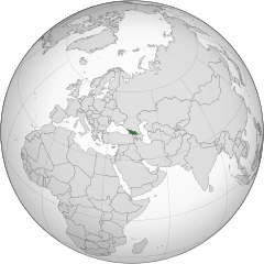
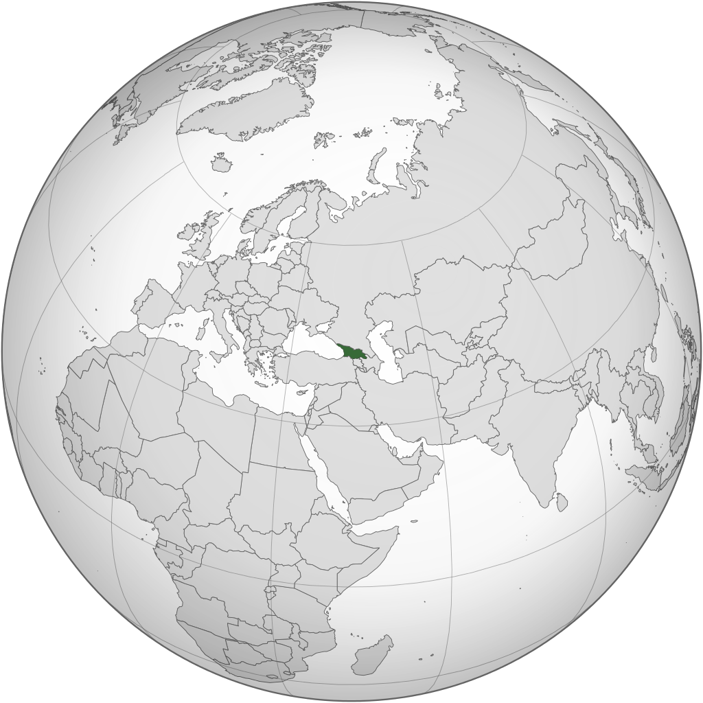
ስዕል:Georgia (orthographic projection).svg

Size of this PNG preview of this SVG file: 553 × 553 pixels. Other resolutions: 240 × 240 pixels | 480 × 480 pixels | 768 × 768 pixels | 1,024 × 1,024 pixels | 2,048 × 2,048 pixels.
ዋና ፋይል (የSVG ፋይል፡ በተግባር 553 × 553 ፒክስል፤ መጠን፦ 302 KB)
ማጠቃለያ
| ማጠቃለያ |
English: Location of Georgia.
.svg) |
| ቀን | |
| ምንጭ | Own work |
| አቅራቢው | Izzedine |
| ሌሎች ዕትሞች |
.svg) .svg) |
| SVG genesis |
.svg)
.svg)
.svg)
.svg)
.svg)
.svg)
.svg)
.svg)
.svg)
.svg)
.svg)
.svg)
.svg)
.svg)
.svg)
.svg)
.svg)
.svg)
.svg)
.svg)
.svg)
.svg)
.svg)
.svg)
.svg)
.svg)
.svg)
.svg)
.svg)
.svg)
.svg)
.svg)
.svg)
.svg)
.svg)
.svg)
.svg)
.svg)
.svg)
.svg)
.svg)
.svg)
.svg)
.svg)
.svg)
.svg)
.svg)
.svg)
.svg)
.svg)
.svg)
.svg)
.svg)
.svg)
.svg)
.svg)
.svg)
.svg)
.svg)
.svg)
.svg)
.svg)
.svg)
.svg)
.svg)
.svg)
.svg)
.svg)
.svg)
.svg)
.svg)
.svg)
.svg)

.svg)

.svg)

.svg)
.svg)
.svg)
.svg)
.svg)
.svg)
.svg)


.svg)
.svg)
.svg)
.svg)
.svg)
.svg)
.svg)

.svg)
.svg)
.svg)
.svg)
.svg)
.svg)
.svg)
.svg)
.svg)
.svg)

.svg)
.svg)
.svg)
.svg)
.svg)
.svg)
.svg)
_without_national_boundaries.svg)
.svg)
.svg)
.svg)
.svg)
.svg)
.svg)

.svg)
.svg)
.png)
.svg)
.svg)

.svg)
.svg)
.svg)
.svg)
.svg)
.svg)
.svg)
.svg)
.svg)
.svg)
.svg)

.svg)
.svg)
.svg)
.svg)
.svg)
.svg)
.svg)
.svg)
.svg)

.svg)
.svg)

.svg)
.svg)
.svg)
.svg)
.svg)
.svg)
.svg)
.svg)
.svg)
.svg)
.svg)
.svg)
.svg)
.svg)
.svg)
.svg)
.svg)
.svg)
.svg)
.svg)
.svg)
.svg)
.svg)
.svg)
.svg)
.svg)
.svg)
_-_Crimea_disputed.svg)
.svg)
.svg)
.svg)
.svg)
.svg)
.svg)
.svg)
.svg)
.svg)
.svg)
.svg)
_political.svg)
.svg)
.svg)
.svg)
.svg)
_-_Crimea_disputed_-_no_borders.svg)
.svg)
.svg)
.svg)
.svg)
.svg)
.svg)
.svg)
.svg)
.svg)
.svg)
.svg)

.svg)
.svg)
.svg)

.png)
.svg)
.svg)
.svg)
.svg)
.svg)
.svg)
.svg)
.svg)
.svg)
.svg)
.svg)
.svg)
.svg)
.svg)
.svg)
.svg)
.svg)
.svg)
.svg)
.svg)
.svg)
.svg)
.svg)
.svg)
.svg)
.svg)
.svg)
.svg)
.svg)
.svg)
.svg)
.svg)
.svg)
.svg)
.png)
.svg)
.svg)
.svg)
_(orthographic_projection).png)
የፈቃድ አይነት፦
I, the copyright holder of this work, hereby publish it under the following license:
This file is licensed under the Creative Commons Attribution-Share Alike 3.0 Unported license.
- You are free:
- to share – to copy, distribute and transmit the work
- to remix – to adapt the work
- Under the following conditions:
- attribution – You must give appropriate credit, provide a link to the license, and indicate if changes were made. You may do so in any reasonable manner, but not in any way that suggests the licensor endorses you or your use.
- share alike – If you remix, transform, or build upon the material, you must distribute your contributions under the same or compatible license as the original.
የፋይሉ ታሪክ
የቀድሞው ዕትም ካለ ቀን/ሰዓቱን በመጫን መመልከት ይቻላል።
.svg&dir=prev)
.svg&offset=20110417101642)
.svg&offset=&limit=20)
.svg&offset=&limit=50)
.svg&offset=&limit=100)
.svg&offset=&limit=250)
.svg&offset=&limit=500)
| ቀን /ሰዓት | ናሙና | ክልሉ (በpixel) | አቅራቢው | ማጠቃለያ | |
|---|---|---|---|---|---|
| ያሁኑኑ | 22:12, 18 ማርች 2015 | | 553 × 553 (302 KB) | Flappiefh | Added Western Sahara, fixed Somalia and removed Kosovo. |
| 12:19, 4 ኦገስት 2013 |  | 553 × 553 (307 KB) | Flappiefh | Added South Sudan. | |
| 21:37, 12 ሴፕቴምበር 2012 |  | 550 × 550 (437 KB) | Palosirkka | Scrubbed with http://codedread.com/scour/ | |
| 02:15, 13 ሜይ 2011 |  | 550 × 550 (562 KB) | Geagea | Reverted to version as of 00:04, 8 January 2011. Original file. | |
| 22:27, 12 ሜይ 2011 |  | 550 × 550 (773 KB) | Shibo77 | Reverted to version as of 05:49, 27 April 2011 sockpuppet | |
| 07:08, 3 ሜይ 2011 |  | 550 × 550 (562 KB) | Pols~commonswiki | Avoid overwriting existing files | |
| 05:49, 27 ኤፕሪል 2011 |  | 550 × 550 (773 KB) | Shibo77 | Reverted to version as of 10:58, 17 April 2011 (reverting sockpuppet's reversion) | |
| 17:57, 17 ኤፕሪል 2011 |  | 550 × 550 (562 KB) | Sigismun | I have been yelled at that we are not allowed to rewrite existing maps. So why not create a separate file? | |
| 10:58, 17 ኤፕሪል 2011 |  | 550 × 550 (773 KB) | Night w | {{Information |Description ={{en|1=Locator map of Georgia}} |Source =Own work |Author =Night w |Date = |Permission = |other_versions = }} match up boxes, reduce lineage | |
| 10:16, 17 ኤፕሪል 2011 |  | 550 × 550 (782 KB) | Night w | try this? |
መያያዣዎች
ወዲህ ፋይል የተያያዘ ገጽ የለም።
ሌሎች ውኪዎች
የሚከተሉት ሌሎች ውኪዎች ይህን ፋይል ይጠቀማሉ፦
- Usage on af.wikipedia.org
- Usage on avk.wikipedia.org
- Usage on az.wiktionary.org
- Usage on en.wikipedia.org
- Usage on es.wikipedia.org
- Usage on fi.wikipedia.org
- Usage on fr.wikinews.org
- Usage on gv.wikipedia.org
- Usage on pap.wikipedia.org
- Usage on pl.wiktionary.org
- Usage on ru.wikinews.org
- Usage on sa.wikipedia.org
- Usage on uk.wikipedia.org
- Usage on uk.wikinews.org
- Usage on zh-classical.wikipedia.org
- Usage on zh.wikipedia.org
.svg)