ስዕል:Ciudades del antiguo Oriente Medio.svg

Size of this PNG preview of this SVG file: 800 × 443 pixels. Other resolutions: 320 × 177 pixels | 640 × 355 pixels | 1,024 × 567 pixels | 1,280 × 709 pixels | 2,560 × 1,419 pixels | 1,247 × 691 pixels.
ዋና ፋይል (የSVG ፋይል፡ በተግባር 1,247 × 691 ፒክስል፤ መጠን፦ 353 KB)
ማጠቃለያ
This W3C-unspecified vector image was created with Inkscape .
| ማጠቃለያ |
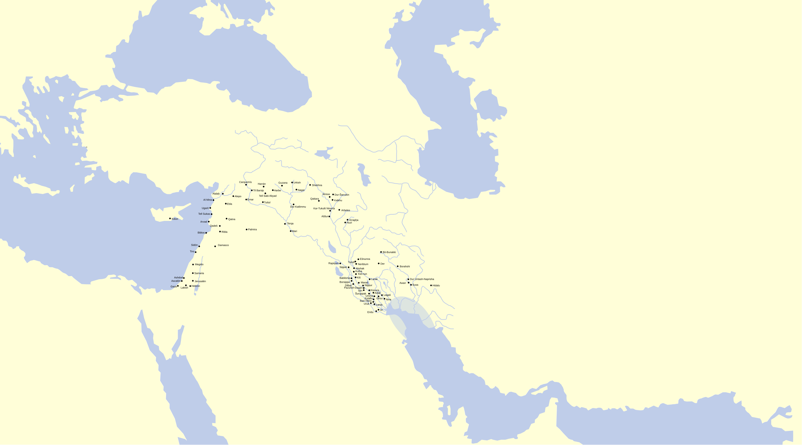
Español: Mapa del Oriente Medio con ciudades de diferentes períodos históricos de la antigüedad. |
| ቀን | |
| ምንጭ |
Español: Realizado sobre este mapa vacío, la situación de las ciudades proviene de estos mapas: 1, 2, 3, 4, 5 y otros del usuario Zunkir. |
| አቅራቢው | Crates |
| የማብዛት ፈቃድ (Reusing this file) |
CC-BY |
የፈቃድ አይነት፦
I, the copyright holder of this work, hereby publish it under the following license:
This file is licensed under the Creative Commons Attribution 3.0 Unported license.
- You are free:
- to share – to copy, distribute and transmit the work
- to remix – to adapt the work
- Under the following conditions:
- attribution – You must give appropriate credit, provide a link to the license, and indicate if changes were made. You may do so in any reasonable manner, but not in any way that suggests the licensor endorses you or your use.
የፋይሉ ታሪክ
የቀድሞው ዕትም ካለ ቀን/ሰዓቱን በመጫን መመልከት ይቻላል።
| ቀን /ሰዓት | ናሙና | ክልሉ (በpixel) | አቅራቢው | ማጠቃለያ | |
|---|---|---|---|---|---|
| ያሁኑኑ | 15:38, 18 ጁን 2015 | | 1,247 × 691 (353 KB) | Jakeukalane | Correcciones de los nombres de ciudades kh→ḫ sh→š Qattaral Zamahe→Qattara/Zamahe→Qattara +Emar Haleb→Alepo Tutul→Tuttul Dur-katlimmu→ Dūr-Katlimmu +Nuzi Trqa→Terqa etc |
| 18:25, 13 ፌብሩዌሪ 2008 |  | 1,247 × 691 (346 KB) | Phirosiberia | {{Information |Description={{es|Mapa del Oriente Medio con ciudades de diferentes períodos históricos de la antigüedad.}} |Source={{es|Realizado sobre este mapa vacío, la situación de las ciudades proviene de estos mapas: |
መያያዣዎች
ወዲህ ፋይል የተያያዘ ገጽ የለም።