ስዕል:Yeniseirivermap.png
Size of this preview: 601 × 600 pixels. Other resolutions: 240 × 240 pixels | 481 × 480 pixels | 988 × 986 pixels.
ዋና ፋይል (988 × 986 ፒክስል፤ መጠን፦ 325 KB፤ የMIME ዓይነት፦ image/png)

|
This map image could be re-created using vector graphics as an SVG file. This has several advantages; see Commons:Media for cleanup for more information. If an SVG form of this image is available, please upload it and afterwards replace this template with
{{vector version available|new image name}}.
It is recommended to name the SVG file “Yeniseirivermap.svg”—then the template Vector version available (or Vva) does not need the new image name parameter. |
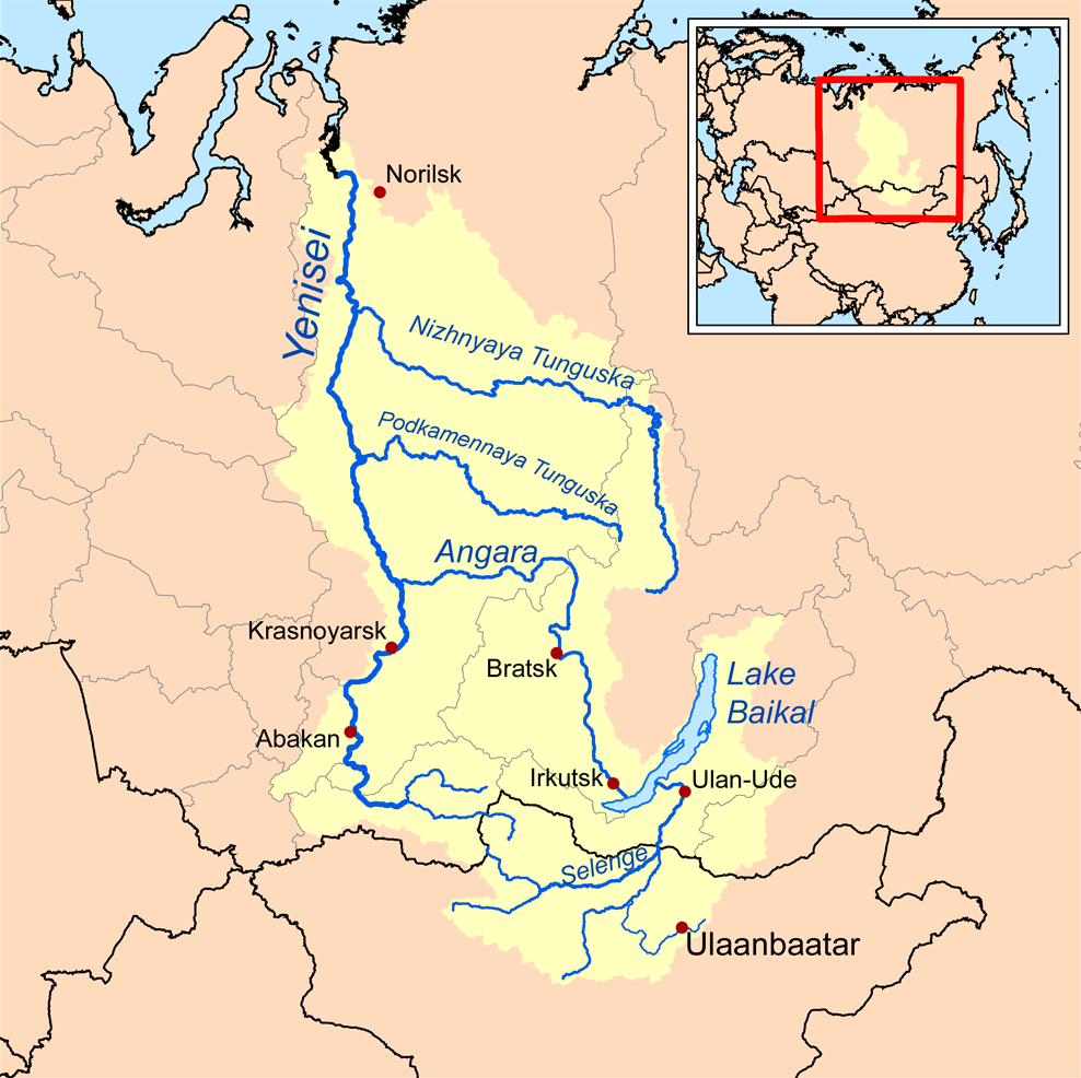
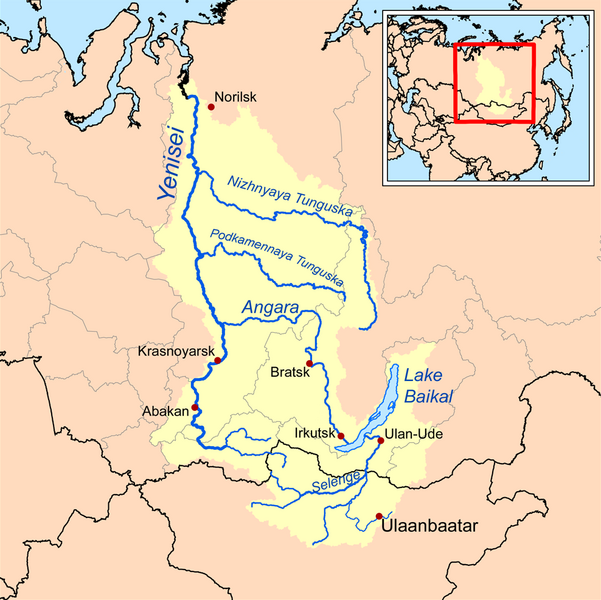
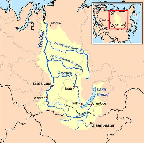
| ማጠቃለያ | This is a map of the Yenisei River drainage basin, with national borders added. |
| ቀን | |
| ምንጭ | Own work using Digital Chart of the World and GTOPO data. |
| አቅራቢው | Kmusser |
|
|
This map image could be re-created using vector graphics as an SVG file. This has several advantages; see Commons:Media for cleanup for more information. If an SVG form of this image is available, please upload it and afterwards replace this template with
{{vector version available|new image name}}.
It is recommended to name the SVG file “Yeniseirivermap.svg”—then the template Vector version available (or Vva) does not need the new image name parameter. |
I, the copyright holder of this work, hereby publish it under the following license:
This file is licensed under the Creative Commons Attribution-Share Alike 3.0 Unported license.
- You are free:
- to share – to copy, distribute and transmit the work
- to remix – to adapt the work
- Under the following conditions:
- attribution – You must give appropriate credit, provide a link to the license, and indicate if changes were made. You may do so in any reasonable manner, but not in any way that suggests the licensor endorses you or your use.
- share alike – If you remix, transform, or build upon the material, you must distribute your contributions under the same or compatible license as the original.
See also
የፋይሉ ታሪክ
የቀድሞው ዕትም ካለ ቀን/ሰዓቱን በመጫን መመልከት ይቻላል።
| ቀን /ሰዓት | ናሙና | ክልሉ (በpixel) | አቅራቢው | ማጠቃለያ | |
|---|---|---|---|---|---|
| ያሁኑኑ | 13:32, 26 ኦክቶበር 2013 | | 988 × 986 (325 KB) | Ras67 | cropped, opt. |
| 18:10, 15 ሴፕቴምበር 2008 |  | 1,000 × 1,000 (414 KB) | Kmusser | {{Information |Description=This is a map of the Yenisei River drainage basin. |Source=Own work using http://www.maproom.psu.edu/dcw/ Digital Chart of the World and [[http://edc.usgs.gov/products/elevation/gtopo30/gtopo30.html GTO |
መያያዣዎች
የሚከተለው ገጽ ወደዚሁ ፋይል ተያይዟል፦
ሌሎች ውኪዎች
የሚከተሉት ሌሎች ውኪዎች ይህን ፋይል ይጠቀማሉ፦
- Usage on af.wikipedia.org
- Usage on ar.wikipedia.org
- Usage on arz.wikipedia.org
- Usage on ast.wikipedia.org
- Usage on azb.wikipedia.org
- Usage on be.wikipedia.org
- Usage on bh.wikipedia.org
- Usage on bn.wikipedia.org
- Usage on bs.wikipedia.org
- Usage on ca.wikipedia.org
- Usage on cs.wikipedia.org
- Usage on cy.wikipedia.org
- Usage on da.wikipedia.org
- Usage on de.wikipedia.org
- Usage on en.wikipedia.org
- Lake Baikal
- Angara
- Yenisey
- Nizhnyaya Tunguska
- New Order (Nazism)
- Soyot
- User:Kmusser/Images
- Tungusic peoples
- Dené–Yeniseian languages
- List of Russian explorers
- Demid Pyanda
- Wikipedia:Graphics Lab/Illustration workshop/Archive/Jan 2011
- Axis powers negotiations on the division of Asia
- Physochlaina
- Yenisei Inscriptions
- Usage on eo.wikipedia.org
View more global usage of this file.