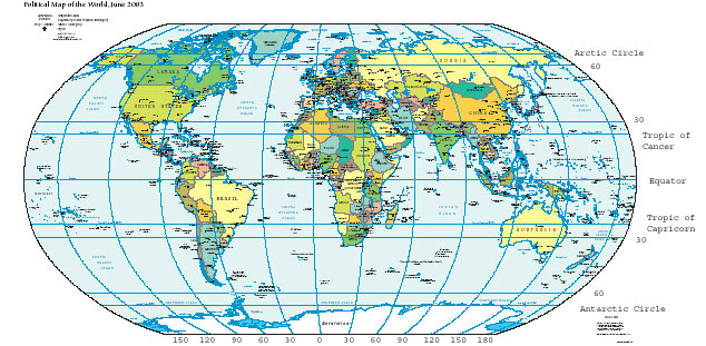
ስዕል:WorldMapLongLat-eq-circles-tropics-non.png
WorldMapLongLat-eq-circles-tropics-non.png (634 × 311 ፒክስል፤ መጠን፦ 93 KB፤ የMIME ዓይነት፦ image/png)
የፋይሉ ታሪክ
የቀድሞው ዕትም ካለ ቀን/ሰዓቱን በመጫን መመልከት ይቻላል።
| ቀን /ሰዓት | ናሙና | ክልሉ (በpixel) | አቅራቢው | ማጠቃለያ | |
|---|---|---|---|---|---|
| ያሁኑኑ | 12:54, 12 ኖቬምበር 2015 |  | 634 × 311 (93 KB) | OgreBot | (BOT): Reverting to most recent version before archival |
| 12:54, 12 ኖቬምበር 2015 |  | 634 × 311 (93 KB) | OgreBot | (BOT): Uploading old version of file from en.wikipedia; originally uploaded on 2004-06-09 02:02:20 by Niteowlneils | |
| 08:59, 8 ፌብሩዌሪ 2006 |  | 634 × 311 (93 KB) | Freshstart~commonswiki | Great circles of latitude. Originally uploaded to [http://en.wikipedia.org/wiki/Image:WorldMapLongLat-special-lats-emph-AntarcticCircle-non.png] by en:User:Niteowlneils. Based on PD image from US government. This series should have migrated to common |
መያያዣዎች
የሚከተለው ገጽ ወደዚሁ ፋይል ተያይዟል፦
ሌሎች ውኪዎች
የሚከተሉት ሌሎች ውኪዎች ይህን ፋይል ይጠቀማሉ፦
- Usage on ace.wikipedia.org
- Usage on af.wikipedia.org
- Usage on anp.wikipedia.org
- Usage on an.wikipedia.org
- Usage on ar.wikipedia.org
- Usage on arz.wikipedia.org
- Usage on ast.wikipedia.org
- Usage on awa.wikipedia.org
- Usage on bg.wikipedia.org
- Usage on bn.wikipedia.org
- Usage on bs.wikipedia.org
- Usage on ca.wikipedia.org
- Usage on ca.wikibooks.org
- Usage on ceb.wikipedia.org
- Usage on da.wikipedia.org
- Usage on de.wikipedia.org
- Usage on dsb.wikipedia.org
- Usage on dty.wikipedia.org
- Usage on el.wikipedia.org
- Usage on en.wikipedia.org
- Usage on en.wikibooks.org
- Usage on en.wikiversity.org
- Usage on en.wiktionary.org
- Usage on eo.wikipedia.org
- Usage on es.wikipedia.org
- Usage on eu.wikipedia.org
View more global usage of this file.


