ስዕል:Map of USA AK full.png
ከዚህ በላይ ማጉላት አይቻልም።
Map_of_USA_AK_full.png (284 × 184 ፒክስል፤ መጠን፦ 19 KB፤ የMIME ዓይነት፦ image/png)

|
File:Map of USA AK full.svg is a vector version of this file. It should be used in place of this PNG file when not inferior.
File:Map of USA AK full.png → File:Map of USA AK full.svg
For more information, see Help:SVG. |
 |
ማጠቃለያ
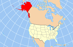
| ማጠቃለያ | Map of USA with Alaska highlighted and shown in true position |
| ቀን | |
| ምንጭ | http://www.nationalatlas.gov/printable/reference.html |
| አቅራቢው | |
| ሌሎች ዕትሞች | File:Map of USA AK full.svg |
የፈቃድ አይነት፦
This map was obtained from an edition of the National Atlas of the United States. Like almost all works of the U.S. federal government, works from the National Atlas are in the public domain in the United States.
Online access: NationalAtlas.gov | 1970 print edition: Library of Congress, Perry-Castañeda Library
|
የፋይሉ ታሪክ
የቀድሞው ዕትም ካለ ቀን/ሰዓቱን በመጫን መመልከት ይቻላል።
| ቀን /ሰዓት | ናሙና | ክልሉ (በpixel) | አቅራቢው | ማጠቃለያ | |
|---|---|---|---|---|---|
| ያሁኑኑ | 20:43, 17 ዲሴምበር 2012 | | 284 × 184 (19 KB) | Ras67 | cropped |
| 16:31, 2 ኤፕሪል 2007 |  | 286 × 186 (20 KB) | MattWright | fix to more standard map colors | |
| 06:20, 2 ኤፕሪል 2007 |  | 286 × 186 (19 KB) | MattWright | {{Information |Description=Map of USA with Alaska highlighted and shown in true position |Source=http://www.nationalatlas.gov/printable/reference.html |Date=2007-04-02 |Author= |Permission= |other_versions= }} Category:Maps of the United States [[Cat |
መያያዣዎች
የሚከተለው ገጽ ወደዚሁ ፋይል ተያይዟል፦
ሌሎች ውኪዎች
የሚከተሉት ሌሎች ውኪዎች ይህን ፋይል ይጠቀማሉ፦
- Usage on ar.wikipedia.org
- Usage on az.wikipedia.org
- Usage on az.wiktionary.org
- Usage on ba.wikipedia.org
- Usage on bn.wikipedia.org
- Usage on ce.wikipedia.org
- Usage on cy.wikipedia.org
- Usage on da.wikipedia.org
- Usage on de.wikipedia.org
- Usage on el.wikipedia.org
- Usage on en.wikipedia.org
- Usage on es.wikibooks.org
- Usage on fa.wikipedia.org
- Usage on fr.wikinews.org
- Usage on ga.wikipedia.org
- Sitka
- Buirg Aleutians Thoir, Alasca
- Buirg Anchorage, Alasca
- Buirg Artach Thiar Thuaidh, Alasca
- Buirg Bristol Bay, Alasca
- Buirg Denali, Alasca
- Buirg Fairbanks Réalta Thuaidh, Alasca
- Buirg Haines, Alasca
- Buirg Juneau, Alasca
- Buirg Leithinis Kenai, Alasca
- Buirg Tairseach Ketchikan, Alasca
- Buirg Oileán Kodiak, Alasca
- Buirg Loch agus Leithinis, Alasca
- Buirg Matanuska-Susitna, Alasca
- Buirg Fána Taobh Thuaidh, Alasca
View more global usage of this file.