ስዕል:BlankMap-Caribbean.png
ከዚህ በላይ ማጉላት አይቻልም።
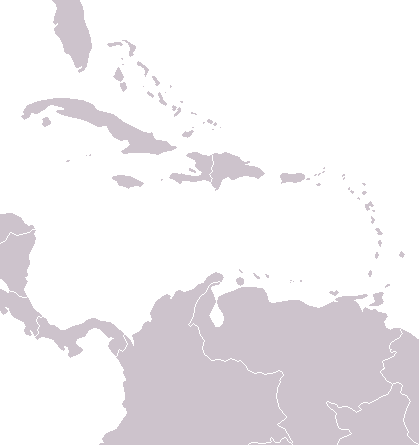
BlankMap-Caribbean.png (419 × 445 ፒክስል፤ መጠን፦ 10 KB፤ የMIME ዓይነት፦ image/png)

|
This locator map image could be re-created using vector graphics as an SVG file. This has several advantages; see Commons:Media for cleanup for more information. If an SVG form of this image is available, please upload it and afterwards replace this template with
{{vector version available|new image name}}.
It is recommended to name the SVG file “BlankMap-Caribbean.svg”—then the template Vector version available (or Vva) does not need the new image name parameter. |
A political map of the Caribbean as of 2004, made by the uploader for Wikipedia.
Vardion, the copyright holder of this work, hereby publishes it under the following license:
| I, the copyright holder of this work, release this work into the public domain. This applies worldwide. In some countries this may not be legally possible; if so: I grant anyone the right to use this work for any purpose, without any conditions, unless such conditions are required by law. |
የፋይሉ ታሪክ
የቀድሞው ዕትም ካለ ቀን/ሰዓቱን በመጫን መመልከት ይቻላል።
| ቀን /ሰዓት | ናሙና | ክልሉ (በpixel) | አቅራቢው | ማጠቃለያ | |
|---|---|---|---|---|---|
| ያሁኑኑ | 05:18, 2 ጁላይ 2006 | | 419 × 445 (10 KB) | Hoshie | Map has been updated to add a pixel or two for Navassa Island, a US territory W of Haiti. |
| 04:55, 8 ዲሴምበር 2004 |  | 419 × 445 (6 KB) | Vardion | a blank map of the Caribbean |
መያያዣዎች
የሚከተሉ 2 ገጾች ወደዚሁ ፋይል ተያይዘዋል፦
ሌሎች ውኪዎች
የሚከተሉት ሌሎች ውኪዎች ይህን ፋይል ይጠቀማሉ፦
- Usage on fa.wikipedia.org
- Usage on ht.wikipedia.org
- Usage on mk.wikipedia.org
- Usage on pt.wikibooks.org
- Usage on sco.wikipedia.org